 Project Britain
British Life and Culture
by Mandy Barrow
- Search our Site
- Project Britain
- Calendars
- Facts and figures
- London
- Great Britain
- Union Flag
- A-Z of Britain
- Customs & traditions
- Britain today
- Daily Life
- Money
- Etiquette
- Monarchy
- Government
- Education
- Tourist Information
- Food and drink
- Sports and leisure
- History
- Kings and Queens
- Superstitions
- Glossary
|
What are the landforms of England?
|
|
|
Please note: We have mainly written about England, as that is the country within the UK where our students live. We would be very happy for schools and visitors to send us information we can add to our website on Wales and Scotland. Much of England is flat or low-lying especially in southern England. Mountains are found in the north. The Cheviot Hills are a range of low mountains forming a border between England and Scotland. They extend 35 miles ( 56 km) is a north-eastern to south-western direction. The hills are part of the Northumberland National Park.
The Pennines , in the north, are a large chain of limestone hills with moorland tops rising to between 600 and 900 metres. The chain runs from Scotland to halfway down the length of England, splitting northern England into northwest and northeast sectors. The Pennines are sometimes called the backbone of England. Other names for the Pennines are Pennine Chain or Pennine Hills.
To the west of the northern Pennines are the Cumbrian Mountains , a mountainous dome of ancient rocks deeply eroded by glaciers. The area of the Cumbrian mountains is the most rugged in England and is more commonly known as the Lake District after the many lakes there.
The highest point in England, Scafell Pike, 3,205 ft. (978m) is part of the Cumbrian Mountains. The Lake District, famous for its lakes and scenic beauty, is one of England's most popular recreation areas. Lake Windermere, one of the area's many lakes, is the largest lake in England. It stretches 10.5 miles (17 kilometers) long and about 1 mile (1.6 kilometers) wide.
The Peak District lies in the southern part of the Pennines. It contains England's first national park, which was established in 1951 . The Peak District covers and area of about 555 sq miles (1,438 sq km). The northern region of the Peak District is covered in moors and oddly shaped hills. The central and southern regions have rolling hills and green valleys.
The North Yorkshire Dales lie east of the Pennines. This national park stretches across 500 square miles (1,295 square kilometers), touching the North Sea. In the south is the Yorkshire moors consisting of low hills covered with coarse marsh grasses and low evergreen shrubs of heather.
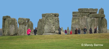
The wide expanse of Salisbury Plain occupies most of the central part of southern England. It covers an area of approximately 300 square miles ( 775 sq km) and is drained to the south by the River Avon. Sailsbury plain is a barren chalk plateau without trees and much of it is used as a pasture for sheep. Many people travel to see Stonehenge, a prehistoric monument located on Salisbury Plain.
The Downs are a series of rolling chalk hills found in southern England. The Seven Sisters are chalk cliffs, part of the coastline of the south-eastern
tip of England.
Dartmoor moorland area is famous for the wild Dartmoor ponies that live there.
Rivers The longest and best known river in England is the Thames which flows through London. It is 346km long.
(The River Severn is the longest in total, but its source is in the mountains of Wales, and the parts which run through England are shorter than the Thames). Other significant rivers include the Ouse, Severn, Trent, Tweed and Wye.
|
|
 © Copyright - please read © Copyright - please read All the materials on these pages are free for homework and classroom use only. You may not redistribute, sell or place the content of this page on any other website or blog without written permission from the Mandy Barrow. |
© Copyright Mandy Barrow 2014
Mandy is the creator of the Woodlands Resources section of the Woodlands Junior website.
The two websites projectbritain.com and primaryhomeworkhelp.co.uk are the new homes for the Woodlands Resources.
Mandy left Woodlands in 2003 to work in Kent schools as an ICT Consultant.
She now teaches computers at The Granville School and St. John's Primary School in Sevenoaks Kent.
Woodlands Junior Homework Help new website


